
- Home
- Climbs
- Aug 07, 2017
-
-
Email -
Facebook -
Pinterest -
Twitter
-
Ken’s High Five — Part Three, Glacier Peak
Glacier Peak, our objective this trip, is the most remote of Washington’s volcanoes. It is a place of beauty, solitude, and perfect kite flying weather. For us, the trip up Glacier Peak was also a chance to raise money for a worthy cause, and the opportunity for one member of our team to finally complete his goal, started in the 1980s, to climb all of the northwest volcanoes.
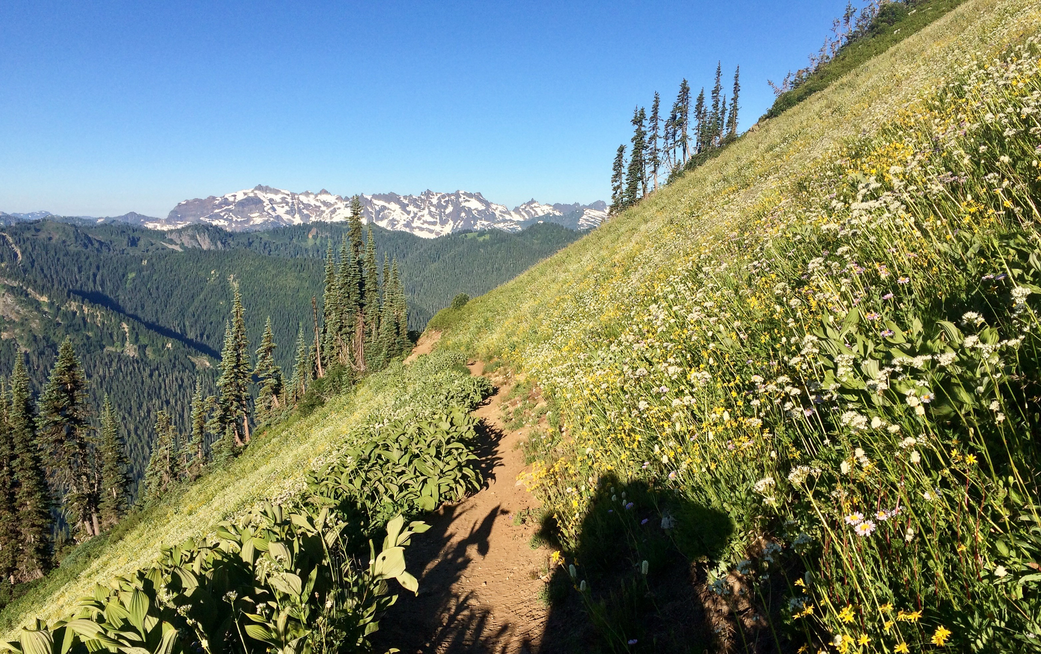
Walking toward White Pass.
After a morning of gear checks and driving, our crew of Tom, Joe, and Ken started off on the North Fork of the Sauk trail through massive old growth towards camp 1. After five miles of flat easy walking the trail steepened and we began following an avalanche path upward. Lupine, Indian Paintbrush and Fireweed surrounded us as we ascended a series of switchbacks towards White pass. As we neared our camp, Sloan peak came into view set against a foreground of alpine wildflowers. Upon arriving at camp, we settled in, ate dinner and went to bed looking forward to our first glimpses of the mountain the next day.

Traverse of White Mountain saddle revealing Glacier Peak.
The following morning, we traversed to a saddle of White Mountain and were treated to a perfectly framed view of Glacier Peak. Still over five miles from the base of the mountain, we pressed on and dropped down onto the White Chuck glacier. This glacier once covered the entire basin but has now retreated to a tiny corner and we could cross on snowfields to Glacier Gap. Glacier Gap, a ridge line between the White Chuck and Suiattle glaciers, would be our camp for the next two nights, as we would be making our push for the summit the next day. We took an afternoon nap and prepped for our summit attempt the next morning.
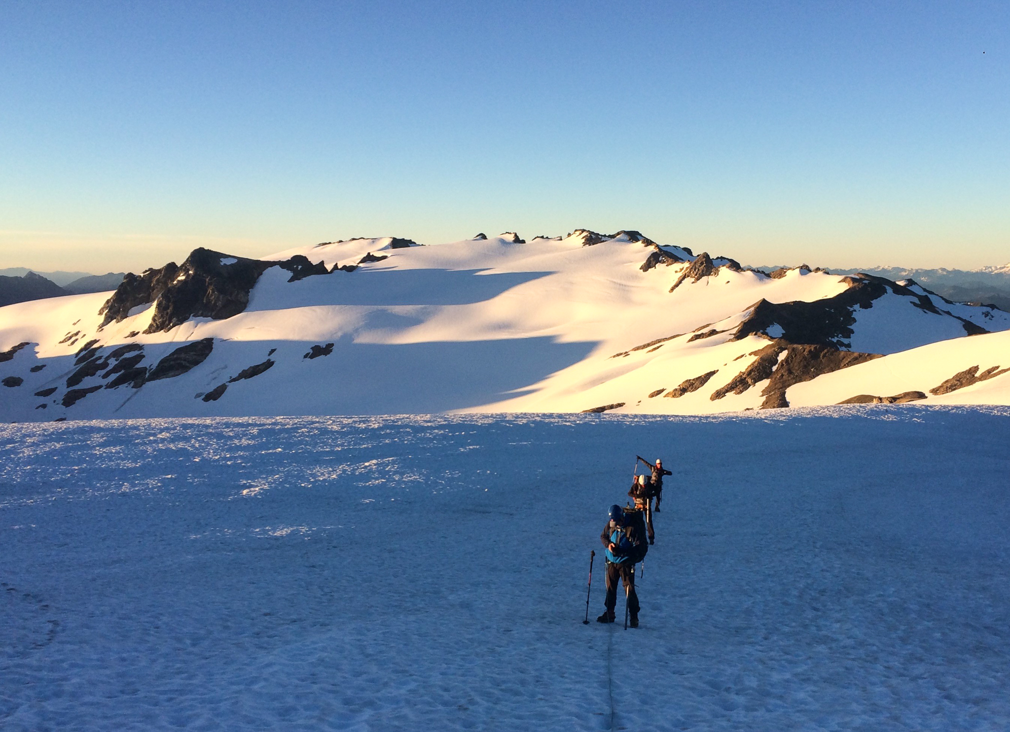
The team of Ken, Joe, and Tom.
Ken, a retired NOAA weather forecaster, did a phenomenal job whistling up good weather, and we awoke to a night full of stars. Leaving camp with light summit packs, we ascended the Gerdine Glacier to below Disappointment Peak and traversed past the rock fall of its cliffs to the Cool Glacier. After coming up this glacier, we found ourselves at the base of the pumice ridge. A short section of pumice walking took us to the summit. This summit meant a lot to our team; for Ken, it was the final summit of his goal and a great way to end three weeks of climbing in the Pacific Northwest. Tom was raising money to support the Alports Center and was able to get a photo with their flag on the summit. Thanks to our continued perfect weather, we spent an hour on the summit taking in breathtaking views of Rainer, Shuksan, Baker, and a sea of other summits below us. Last but not least, we found time for a celebratory kite flight!
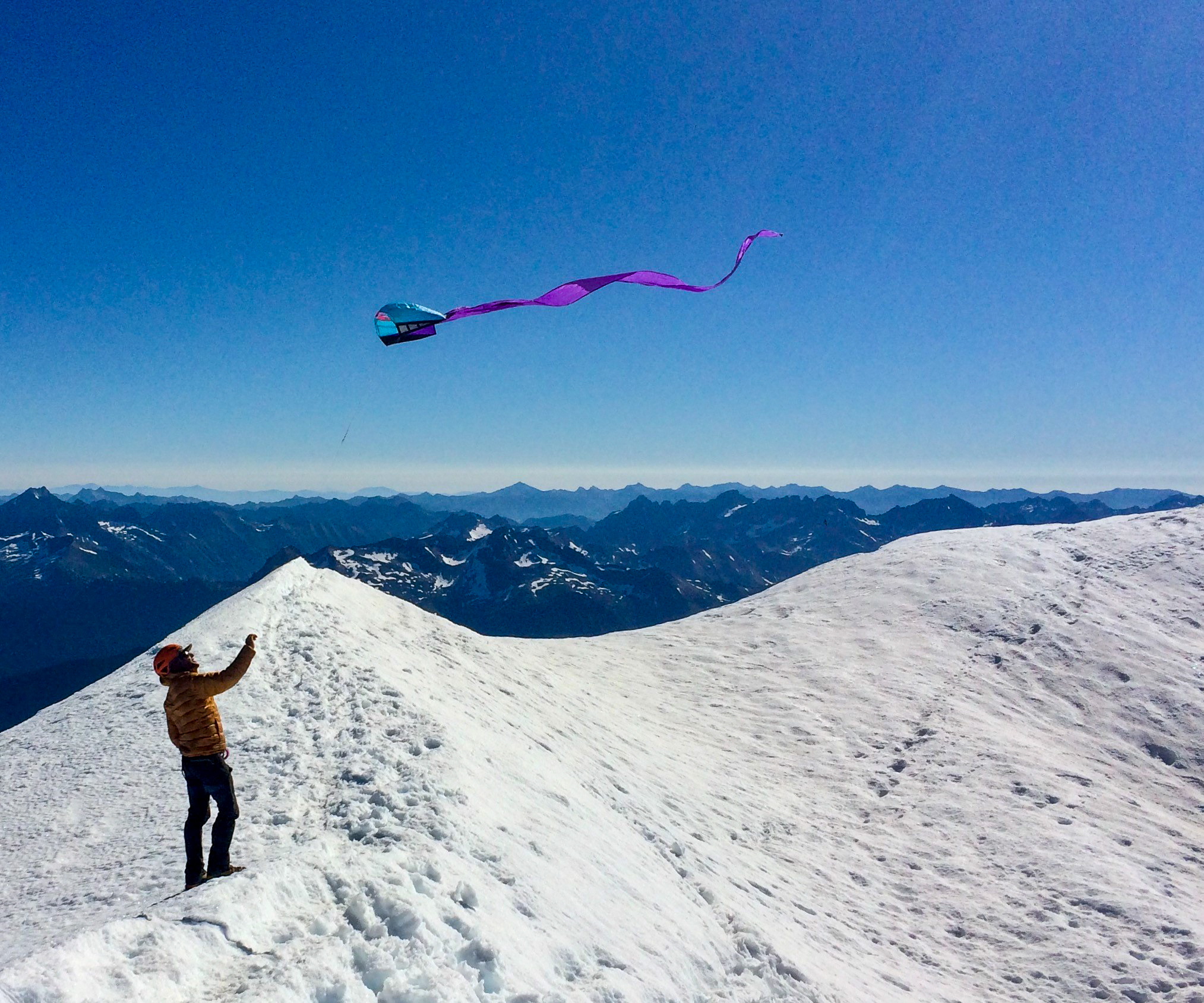
Kite flying on Glacier Peak.
After our descent from the summit, we had the afternoon to relax and take in the beautiful scenery from Glacier Gap and look back at Glacier Peak. Over the next two days we headed out the way we had come, across glaciers, through wildflower meadows, and along ridge lines. At the trailhead, we hopped in the car and headed for home, with a well-deserved stop for burgers in Darrington. Congratulations to all the team and especially to Ken for finishing his final northwest volcano!
~ Words and photos, Madness guide Zach Keskinen