- Home
- Treks
- Oct 13, 2014
-
-
Email -
Facebook -
Pinterest -
Twitter
-
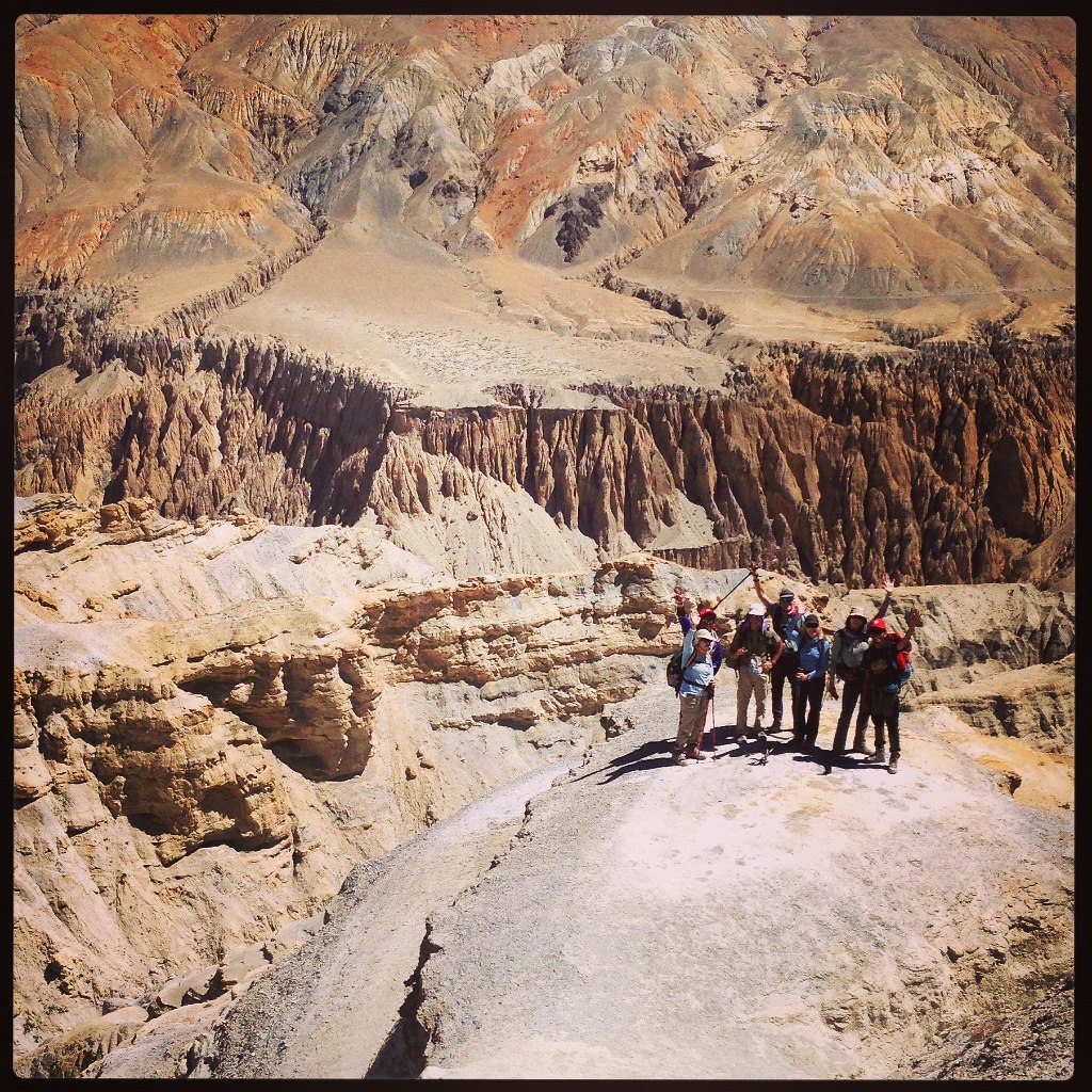
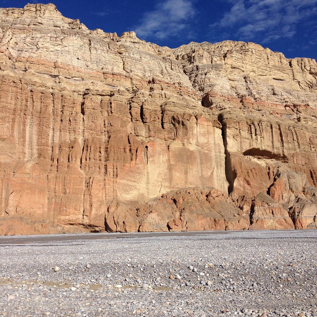
Mustang Trek — High Altitude Desert

All photos by Deana Zabaldo
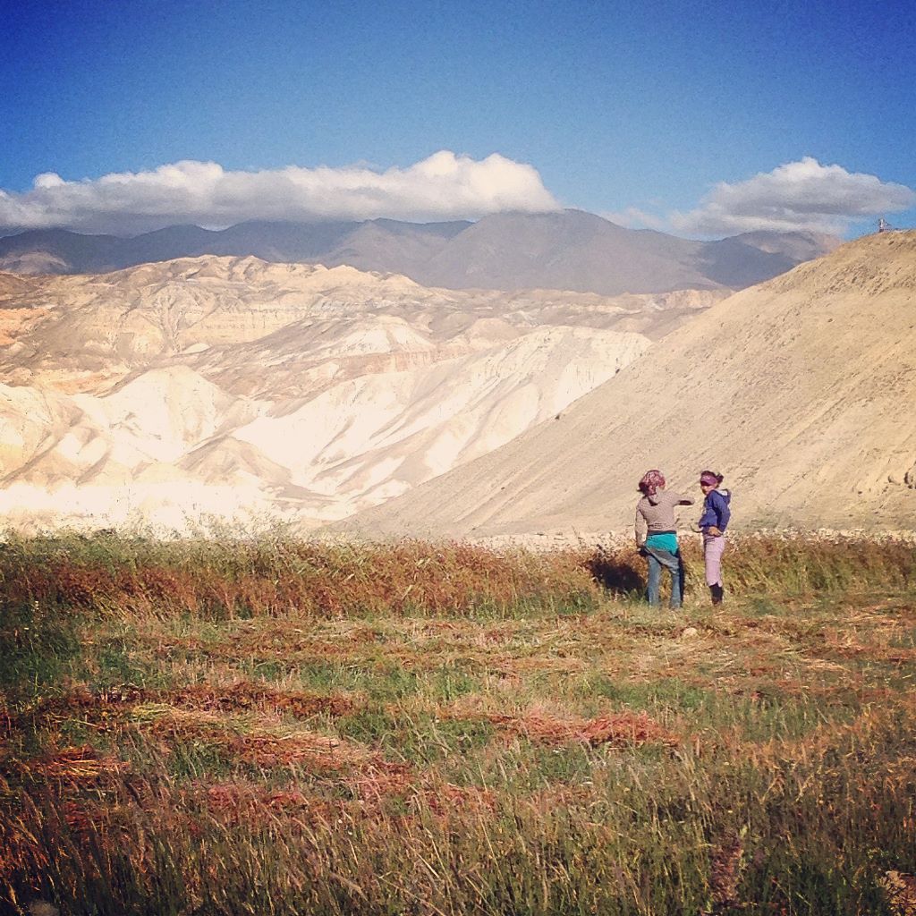
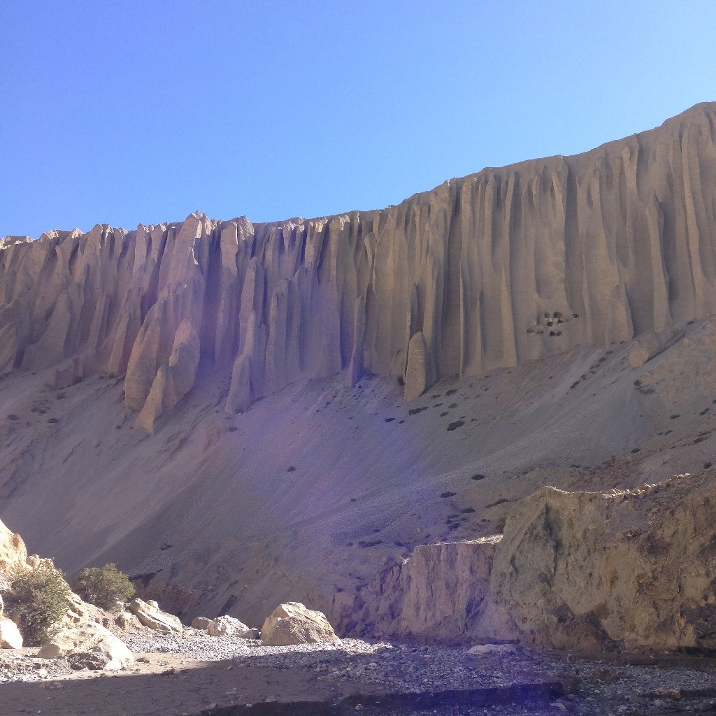
Upper Mustang is mostly a high altitude desert — an expansive, endless sea of land at roughly 12,000 feet. Dendritic canyons fan out across miles. Plateaus with scrub brush end abruptly in fluted columns eroded by weather and time. Caves are everywhere — some ancient habitats, some treasuries of Buddhist art and scripture, some empty and never known. Wind and sun define the landscape.
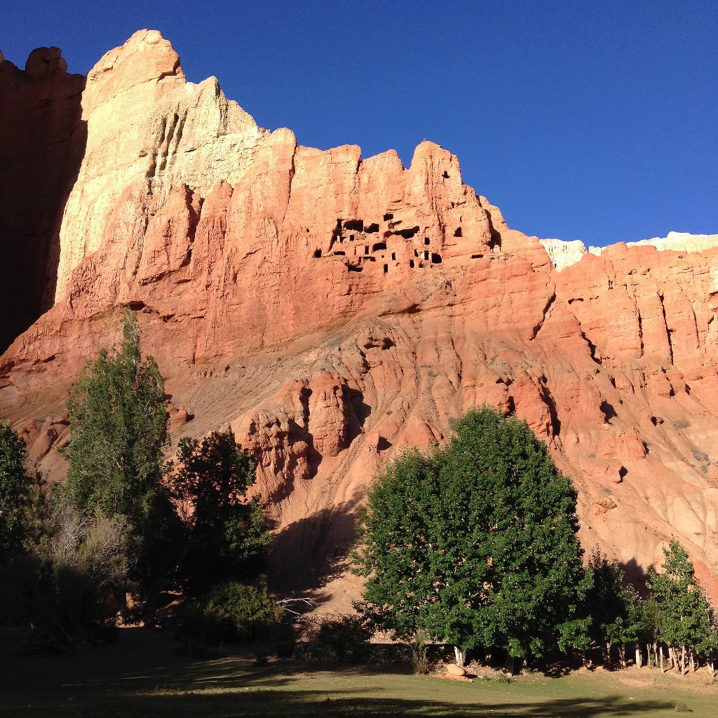
Cave dwellings in the red demon’s blood cliffs — people lived in caves throughout the area moer than 2500 years ago.
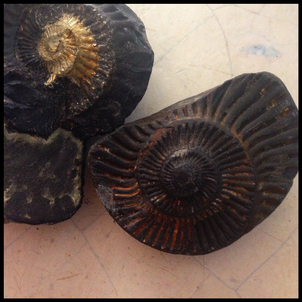
Rock comes in forty varieties, and cliffs reveal sedimentary layers now upended and nearly vertical. These mountains were once the bottom of the primordial Tethys Sea, separating India from China. We find 250 million year old ammonite fossils in the river bed — sea creatures turned to stone and raised to the top of the world as earth’s tectonic plates collided.
One side of a valley is green with low foliage where rain drops as it meets the mountain peaks; the facing side of the valley is dry and dusty, devoid of rain. Where rivers flow, they are channelled to irrigate trees and fields, to support the greenery of life. Where water is drying up, a whole town is moving away, unable to survive. Old adobe chortens and homes stand in smooth ruins, testament to the pressures of nature and the resilience of humans here.
~ MM Guide Deana Zabaldo