
- Home
- Expeditions
- Dec 18, 2012
-
-
Email -
Facebook -
Pinterest -
Twitter
-
Colombia Expedition Wrap-Up
Climbing and trekking in Colombia is not yet on people’s tick list, but we think it should be if you want to get off the beaten Gringo path. Check out our most recent trip there!
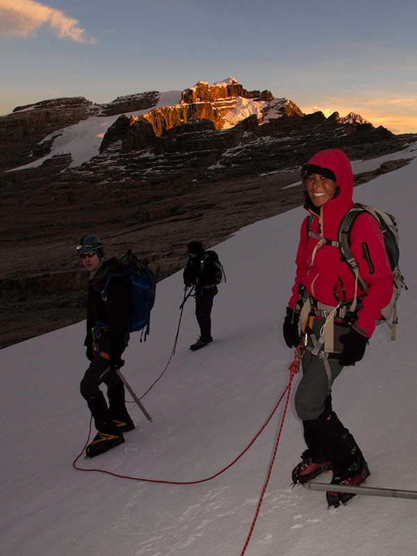
December 11th, we returned from Cocuy National Park in Colombia after a successful, first Mountain Madness trip to the Colombian Andes. The group members, Lily and Troy, summited all 5 mountains with beautiful weather and very good climbing times.
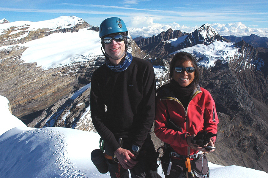
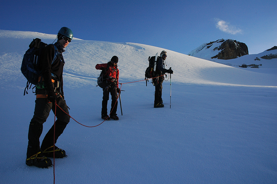
Our team members, Troy and Lily. Juan Carlos Gonzalez’s photo
On December 5th we completed our first acclimatization hike to the Monserrate Sanctuary located a few miles away from the main mountain range. The 12,520 ft peak offers a great warm-up for the treks to come. The climb follows a nice trail, which elevates gradually from 10,500 ft. During the hike we got a sweeping view over the whole mountain range from north to south. The weather was mostly clear and we could see two of our main goals: Concavo and Toti peaks.
View from the summit of Concavo. Juan Carlos Gonzalez’s photo
The next morning, we drove up to Hacienda la Esperanza (an idyllic Hacienda with a long history of sheep farming) where we started our hike to Pico del Aguila. Located on the outskirts of the mountain range, it stands at 13,450 ft. This was one of the most picturesque hikes, as it ascends through a very beautiful green valley with meadows, flowers, and rock faces on the periphery.
View from Pico del Aguila to Monserrate. Juan Carlos Gonzalez’s photo
View from Pico del Aguila to Ritacuba Blanco. Juan Carlos Gonzalez’s photo
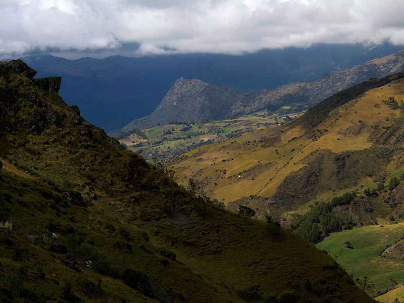
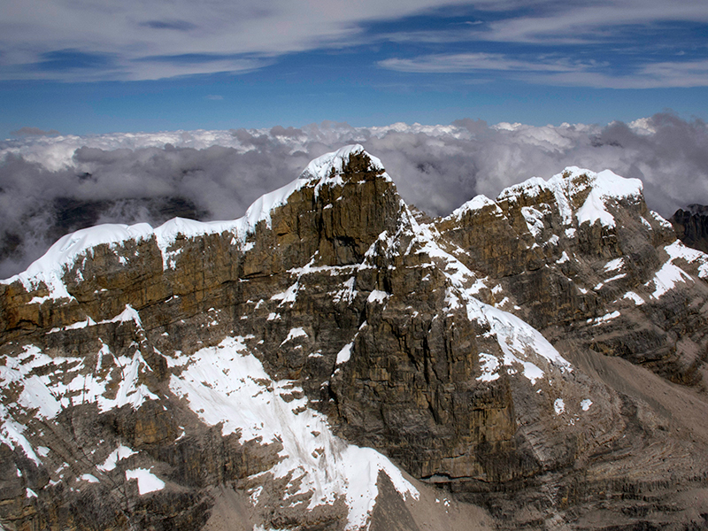
The trail is almost nonexistent, and any place is good for enjoying the solitude of the mountains. After a steep climb toward the final ridge, we arrived at the rocky summit and enjoyed splendid views over the Concavo and Lagunillas valleys. In the background, we could see the Pan de Azucar peak, with its the square rock known as the Devil’s Pulpit; a trademark of Sierra Nevada del Cocuy. We spent the night at the lovely Hacienda and enjoyed the typical local goat dish.
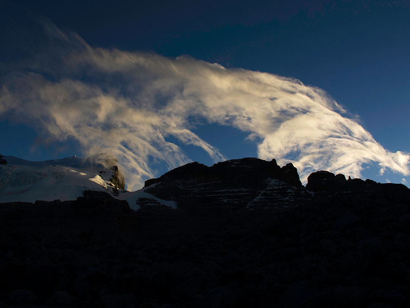
Pan de Azucar. Juan Carlos Gonzalez’s photo
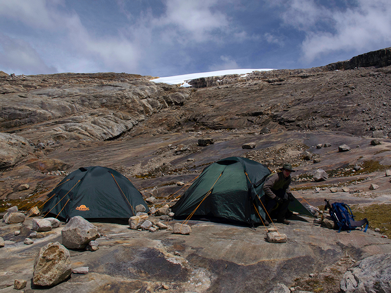
On December 7th we established our Base Camp on the white sandy shores of Laguna Grande de la Sierra, at an altitude of 14,809 feet. Our main goal was Concavo, which stands 17,060 ft above sea level. We started the climb early in the morning of December 8th under a clear, starry night sky with the Southern Cross accompanying us most of the climb.
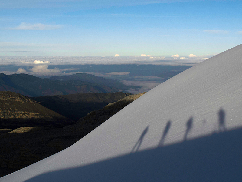
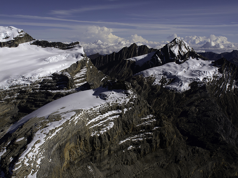
View from the Concavo glacier. Juan Carlos Gonzalez’s photo
Since the weather and mountain conditions were just perfect, we chose the direct route instead of the normal route. This direct route starts at the bottom of the glacier and ascends most of the way over the glacier with a couple of steep sections that make the climb very exciting. We reached the summit with a clear blue sky and a spectacular view into the lower valleys and the surrounding summits from both north and south. The entire climb took the group 7 1⁄2 hours, which is an excellent time for such a climb.
Juan Carlos Gonzalez’s photo
Concavo Peak. Juan Carlos Gonzalez’s photo
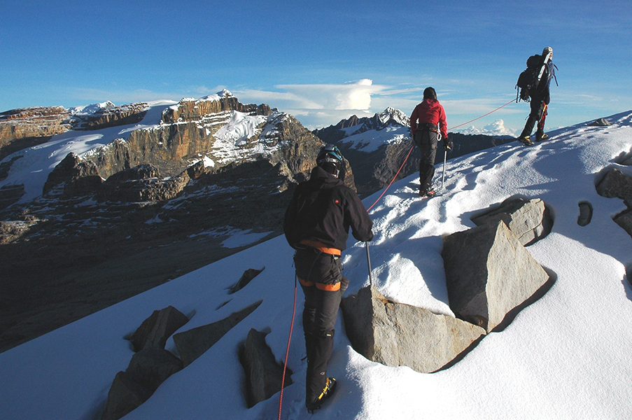
On the Concavo Glacier. Juan Carlos Gonzalez’s photo
Instead of taking a rest day, following Concavo, the group chose to go for Toti peak (16,460 ft), which is located on the other side of the Laguna. Even though the climb is lower than Concavo it is a bit more technical and presents some mixed terrain and a very long moraine. We started at 3:30 am, again under a perfect night sky and a very comfortable temperature. By the time we approached the last section of the climb, the sun had risen and we had awesome views of the Eastern side of the range.
Ascending Toti’s glacier. Juan Carlos Gonzalez’s photo
The Laguna de la Plaza, with its deep blue-green waters, appeared slowly as the morning light began to shine on the water surface. Looking into the lower valley where the clouds cleared we could see the winding rivers of the lowlands vanish into a mist of hot air in the Arauca region. There was no wind at all and the temperature was very nice. We spent some time at the summit, enjoying the views and a snack! We completed the climb in 6 1⁄2 hours– another excellent time. We relaxed the rest of the day and enjoyed the lake and the nice surroundings.
On Toti’s summit ridge. Juan Carlos Gonzalez’s photo
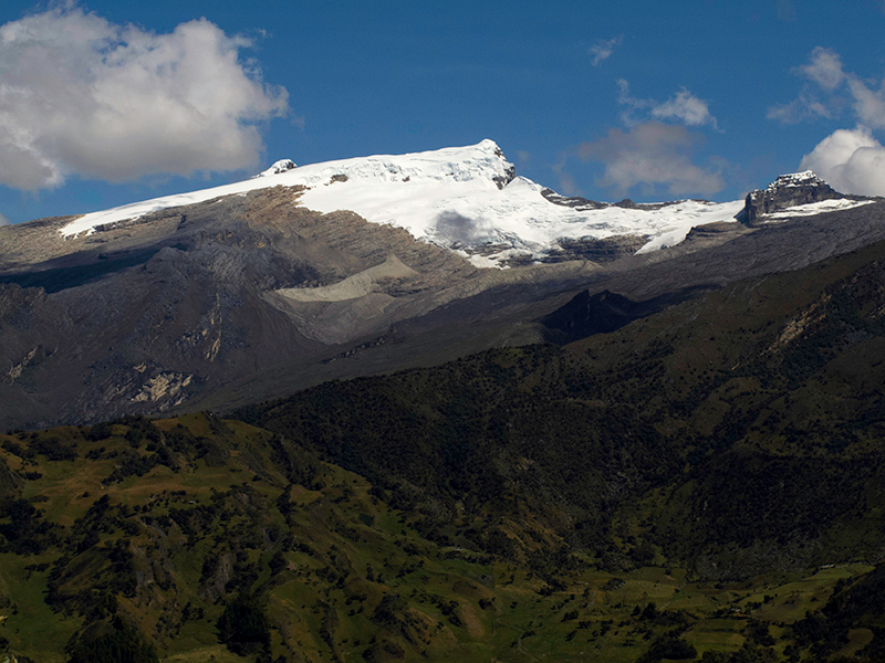
Now, our focus turned to our last and main goal of the trip: Ritacuba Blanco, the highest summit of Sierra Nevada del Cocuy. We left Laguna Grande de la Sierra, descended to Hacienda La Esperanza and drove along the range to the Kanwara huts, located on the north end of the Sierra. We spent the night at a great spot with a panoramic view of many of the Western summits.
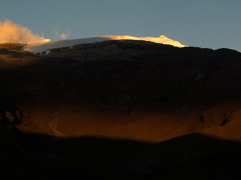
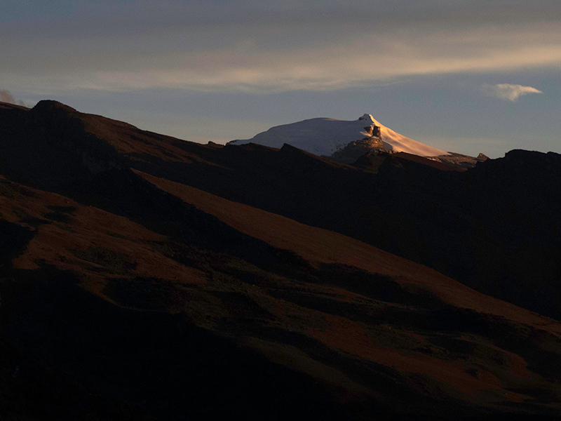
Sunrise over Ritacuba Blanco and Negro. Juan Carlos Gonzalez’s photo
On the morning of Dec. 10th we started our hike towards to Ritacuba’s high Camp at 15,075 ft. The sky looked different already and a weather change was occurring. There had been quite some wind during the night, but had receded by the morning. We reached High Camp before noon and spent the rest of the day preparing the gear and resting for the climb.
Ritacuba Blanco high camp. Juan Carlos Gonzalez’s photo
We agreed to start at 3:00 am and went to bed after an early dinner. At about midnight the wind started again and it increased slowly until reaching a peak of around 35 mph. Even though the team was ready to go at the scheduled time, we waited until 5:00 am as the wind usually decreases its speed towards sunrise. Upon departure, the wind speed had already dropped but was still was blowing quite hard. It allowed us to ascend slowly by the exposed moraine.
Ritacuba Negro and Norte from Ritacuba Blanco. Juan Carlos Gonzalez’s photo
We followed the rocky upper ridge to the beginning of the glacier, geared up, and ascended against the wind by the wide-open glacier. After a couple of hours, we reached the place called La Bifurcacion (the point where the Ritacuba Blanco and Negro share the ridge) and the wind speed had already dropped to a third of its initial speed.

Ritacuba Blanco’s summit ridge. Juan Carlos Gonzalez’s photo
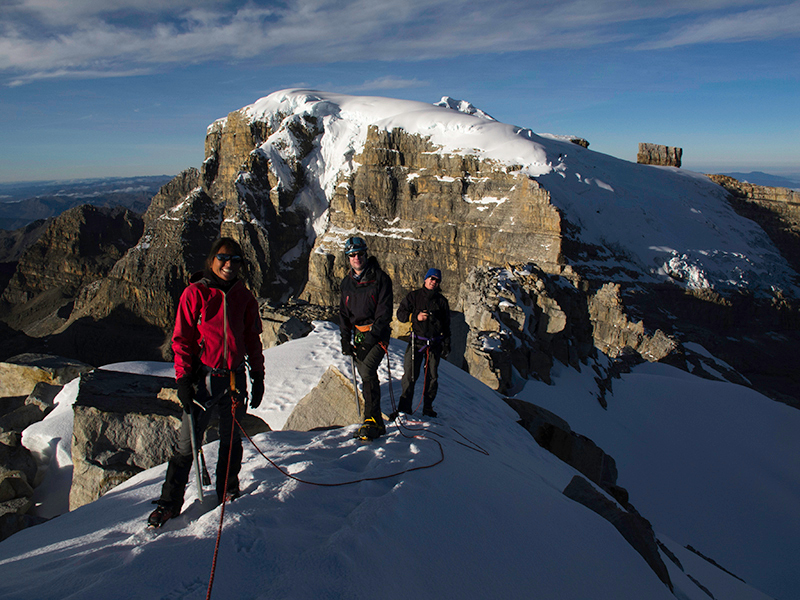
The last ridge was a slow march because of altitude, but was accompanied by incredible sights to the beautiful rock face of Ritacuba Negro and the southern peaks. After nearly 4 1⁄2 hours of climbing, the whole team stood at the summit of Ritacuba Blanco. To our luck, we had a clear view to the lower valley of Valle de los Cojines and panoramic sights to both the northern and southern peaks; almost all of them were visible, and all for ourselves.
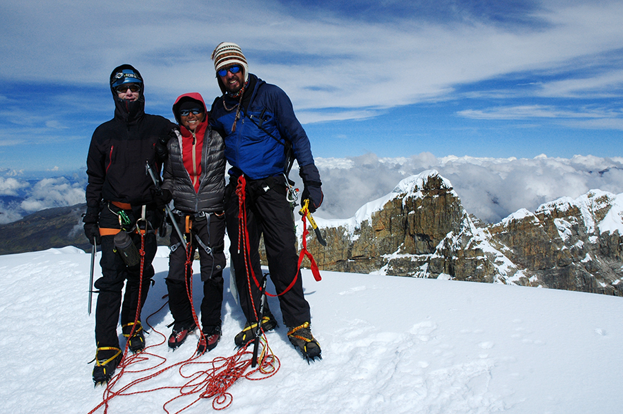
On the summit of Ritacuba Blanco. Juan Carlos Gonzalez’s photo
We descended strait to the Kanwara huts, which took us about 3 hours (an excellent time) and drove back to Cocuy after completing a great climbing trip with all goals achieved!
~ MM Guide Juan Carlos Gonzalez
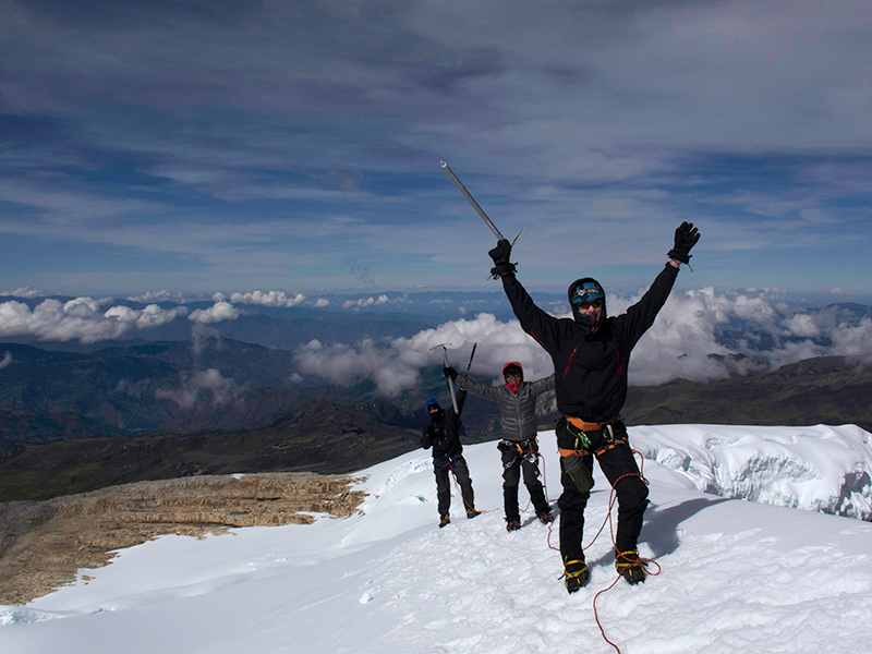
Congratulations! Juan Carlos Gonzalez’s photo